1. Topographic Maps of Ukraine
One of the most valuable resources for Ukrainian genealogists is the collection of 1:100,000 topographic maps of Ukraine hosted by the Berkeley Library. These maps are dated 1942 and show remarkable detail, including villages that had fewer than a thousand people at the time.
These maps are invaluable for locating the exact position of ancestral villages, many of which may have been renamed or no longer exist. The level of detail allows researchers to identify small settlements, rivers, and geographic features that can help confirm family origins.
2. JewishGen ShtetlSeeker
The JewishGen ShtetlSeeker is an indispensable tool for researchers of all backgrounds working in Central and Eastern Europe. Using data from the U.S. Defense Mapping Agency (DMA) Geographic Names Database (GNDB), this tool provides foreign geographic names approved by the US Board on Geographic Names.
Key features of ShtetlSeeker include:
- Search towns using exact spelling or the Daitch-Mokotoff Soundex system
- Display latitude and longitude for each location
- Show distance to the country’s capital city
- List all towns within a certain distance of given coordinates
- Cross-reference multiple spellings and historical names
This is particularly useful for Ukrainian research since village names have changed frequently with shifting borders and administrations over the centuries.
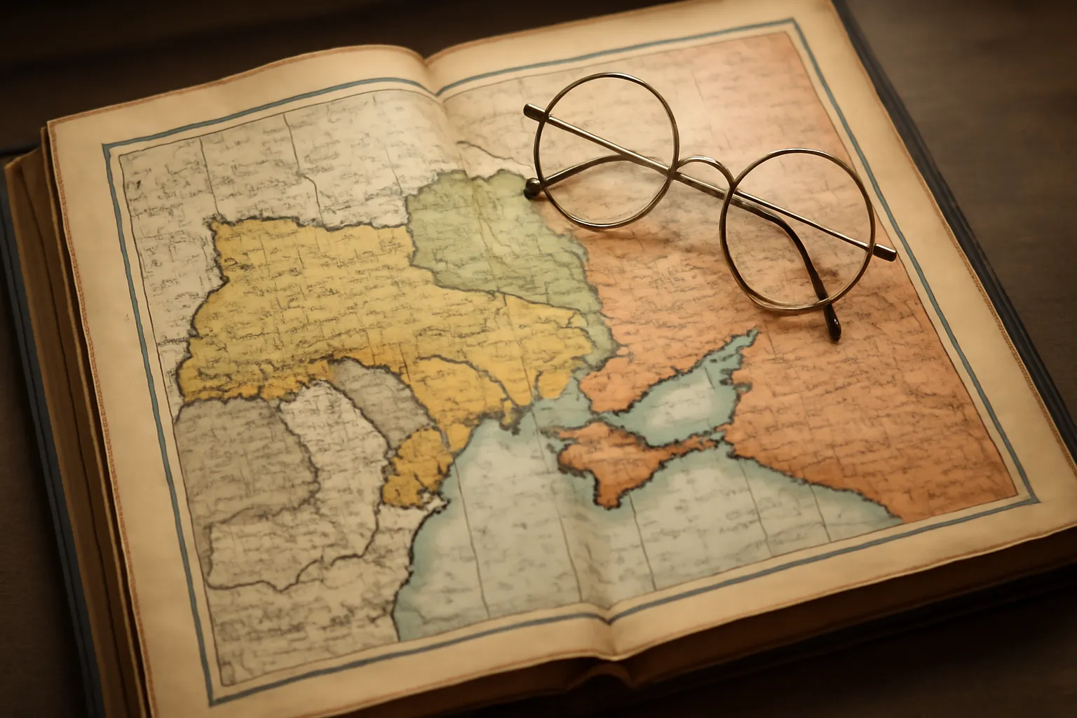
3. Historical Atlas of Ukraine
“Ukraine: A Historical Atlas” by Paul Robert Magocsi is an excellent resource for anyone beginning Ukrainian genealogy research. This atlas provides a visual understanding of the complexity of Ukraine’s changing borders throughout history.
Understanding the historical boundaries is crucial for genealogical research because:
- Administrative divisions changed frequently under different empires (Austro-Hungarian, Russian, Polish, Soviet)
- Village names were transliterated differently depending on the ruling power
- Church and civil records were kept by different jurisdictions at different times
- Provincial boundaries affected where records were stored
4. Rootsweb Ukrainian Genealogy Resources
Rootsweb hosts a comprehensive Ukrainian genealogy section with both old and new maps of Ukraine, surname searches, and extensive genealogy information and research tools.
Resources available through Rootsweb include:
- Historical and modern maps of Ukraine
- Surname search databases
- Links to genealogy mailing lists and forums
- Research guides and methodology articles
- Connection to other Ukrainian researchers worldwide
5. MapQuest and Global Gazetteer
For modern-day location research, MapQuest remains a useful tool for locating towns whether for family tree research or finding local addresses in Ukraine and Canada.
The Global Gazetteer is a directory of 2,880,532 of the world’s cities and towns, sorted by country and linked to a map for each town. This resource is particularly helpful for:
- Confirming the current status of ancestral villages
- Finding nearby towns that may hold relevant records
- Understanding the geographic relationship between settlements
- Downloading tabulated data for each country
6. Church Records in the LDS Family History Library
Cities, Regions/Oblasts and Church Records found in the LDS Family History Library Catalog represent one of the most important resources for Ukrainian genealogists. The Church of Jesus Christ of Latter-day Saints has microfilmed millions of records from Ukraine, including:
- Birth, marriage, and death records from various churches
- Greek Catholic (Uniate) parish records
- Orthodox church registers
- Roman Catholic records from mixed communities
- Civil registration records
These records are organized by region and can be accessed through local Family History Centers worldwide or increasingly through the FamilySearch website.
7. Tips for Using Map Resources Effectively
When conducting Ukrainian genealogy research using maps, keep these important tips in mind:
- Record multiple spellings of village names, as they may appear differently on maps from different eras
- Note the administrative divisions (oblast, raion, powiat) as these help locate records
- Cross-reference with neighboring villages to confirm you have the correct location
- Check maps from different periods as borders shifted between the Austro-Hungarian Empire, Russian Empire, Poland, and the Soviet Union
- Use both Latin and Cyrillic spellings when searching databases
Understanding the geographic context of your ancestors’ lives enriches your genealogical research and helps you locate the records that tell their stories. If you are planning a research trip to Ukraine to visit ancestral villages in person, this travel guide to Ukraine offers practical advice for navigating the country and its regions.
8. Tracing Village Boundaries Across Empires Using Historical Maps
One of the greatest challenges in Ukrainian genealogy is that the very same village may have belonged to several different empires, kingdoms, and administrative systems over the course of just a few generations. A village in western Ukraine might have been part of the Kingdom of Galicia and Lodomeria under Habsburg Austria, then transferred to Poland after 1918, incorporated into the Soviet Union in 1939 or 1945, and finally become part of independent Ukraine in 1991. Each change in sovereignty brought new administrative boundaries, new record-keeping systems, and frequently new names or spellings for the same settlement.
Historical maps are the genealogist’s most powerful tool for untangling these shifts. By comparing maps from different periods, you can determine which district (powiat, raion, or Bezirk) your ancestral village belonged to at a given time. This in turn tells you which archive, church diocese, or civil registry would have held the records you need. For example, a village that fell within a particular Greek Catholic deanery under Austria-Hungary would have had its parish records sent to a different central archive than one that was under Russian Orthodox jurisdiction just a few dozen kilometres to the east.
9. The Josephine and Franciscan Cadastral Maps of Galicia
For researchers with ancestors from Galicia (the western Ukrainian and southeastern Polish region that was part of the Habsburg Empire), two series of cadastral maps are of extraordinary value. The Josephine Cadastral Survey (Josephinische Landesaufnahme), conducted in the 1780s under Emperor Joseph II, produced the first systematic military mapping of Galicia. These maps show individual villages, field boundaries, forests, rivers, and roads at a remarkably detailed scale, offering a snapshot of the landscape as your ancestors knew it in the late eighteenth century.
The Franciscan Cadastral Survey (Franziszeische Landesaufnahme), carried out between the 1820s and 1860s, updated and refined the earlier Josephine maps. The Franciscan maps are often accompanied by written cadastral records (Grundbuch) that list property owners by name, making them a direct genealogical source. If your ancestor owned or leased land in a Galician village, there is a real chance their name appears in the Franciscan cadastral registers. These maps and registers are held at the Austrian State Archives (Osterreichisches Staatsarchiv) in Vienna and at regional archives in Lviv, and many have been digitized in recent years.
10. Online Map Resources: MapyWIG, Mapster, and Austrian Cadastral Maps
The internet has transformed access to historical cartography. Several key online platforms deserve a place in every Ukrainian genealogist’s toolkit:
- MapyWIG (mapy.amzp.pl) — This Polish-language portal hosts digitized versions of the Wojskowy Instytut Geograficzny (WIG) maps, which are detailed interwar Polish military maps from the 1920s and 1930s. These maps cover all of former eastern Galicia (now western Ukraine) and show villages, churches, cemeteries, and even individual farmsteads. They are indispensable for locating small settlements that may not appear on modern maps.
- Mapster.pl — A powerful map overlay tool that allows you to layer historical maps on top of modern satellite imagery. You can compare Austrian, Polish, and Soviet-era maps side by side, making it easy to see how village boundaries shifted and which old landmarks still exist today. Mapster supports the Josephine, Franciscan, and WIG map series as well as nineteenth-century Russian military maps of central and eastern Ukraine.
- Austrian Cadastral Maps (mapire.eu) — The MAPIRE portal, developed by the Arcanum Institute in Budapest, provides seamless online access to the first, second, and third Habsburg military surveys. You can browse Galicia at village level, toggle between historical and modern views, and pinpoint the exact location of your ancestral settlement within its eighteenth- or nineteenth-century context.
- Old Maps Online (oldmapsonline.org) — A meta-search engine that aggregates historical maps from libraries and archives worldwide. Enter the coordinates of your ancestral village and the site will return a list of all available historical maps covering that area, with links to the holding institution’s digital collection.
11. Correlating Old Village Names with Modern Names Using Maps
Village names in Ukraine have been subject to repeated changes driven by language policies, transliteration conventions, and political decisions. A single village might be recorded as Boryslav in Ukrainian, Boryslaw in Polish, and Borislav in German or Russian sources. Smaller settlements often had entirely different names under different administrations, and some were merged into neighboring villages during Soviet-era consolidation campaigns in the 1940s and 1950s.
The most reliable method for correlating old names with modern ones is to use geographic coordinates as the common reference point. First, locate the village on a historical map (such as a WIG or cadastral map) and note its position relative to nearby rivers, roads, or larger towns. Then switch to a modern map or satellite view and find the same geographic features. Tools like Mapster.pl make this overlay process nearly effortless. You can also consult the GeoNames database (geonames.org), which lists alternate historical names for many Ukrainian settlements, or the AGAD Geographical Dictionary of the Kingdom of Poland (Slownik Geograficzny Krolestwa Polskiego), a nineteenth-century encyclopedia that describes thousands of Galician and Volhynian villages with their administrative details, population figures, and church affiliations.
By combining multiple map layers with gazetteers and name dictionaries, you can build a confident identification of your ancestral village even when the name has changed beyond easy recognition. This geographic detective work is one of the most rewarding aspects of Ukrainian genealogical research.
Frequently Asked Questions
The Berkeley Library hosts 1:100,000 topographic maps of Ukraine dated 1942, showing villages with fewer than 1,000 people. The JewishGen ShtetlSeeker database and the Global Gazetteer with over 2.8 million cities and towns are also excellent resources for locating ancestral villages.
The JewishGen ShtetlSeeker allows you to search towns in Central and Eastern Europe using exact spelling or the Daitch-Mokotoff Soundex system. It displays latitude and longitude for each location, as well as the distance to the country's capital city.
Yes, the LDS Family History Library Catalog contains church records organized by cities, regions, and oblasts in Ukraine. These can be accessed through the Rootsweb Ukrainian genealogy resources page.
Ukraine: A Historical Atlas by Paul Robert Magocsi is considered an excellent resource for beginners. It provides a visual understanding of the complexity of Ukraine's changing borders and administrative divisions over the centuries.