Why Homestead Records Are a Gateway to Ukrainian-Canadian Family History
For researchers tracing Ukrainian ancestry in Canada, the ship manifest is rarely the end of the story — it is often the beginning. Once an ancestor arrived in Canada, typically between 1891 and 1914, the next chapter of their documented life unfolded not in a church register but in the offices of the Canadian government’s land administration system. Under the Dominion Lands Act of 1872, the federal government offered any eligible adult male a quarter section (160 acres) of prairie land for a ten-dollar registration fee and the promise to cultivate and settle it. Hundreds of thousands of Ukrainian settlers took that offer.
The administrative machinery that processed those homestead applications created a documentary record that genealogists can use to extraordinary effect. A complete homestead file can establish an ancestor’s name in its original Ukrainian spelling, their declared place of origin in Galicia or Bukovyna, the names and ages of their children, the date they arrived in Canada, and the precise coordinates of the farm they built. For researchers whose family paper trail grows thin before the ship manifest, the homestead record is often the bridge to Ukrainian archives.
This guide covers the complete process of finding, accessing, and interpreting homestead records for Ukrainian-Canadian ancestors: what documents survive, how to search the Library and Archives Canada database, how to decode the Dominion Land Survey system, and what to do when records are incomplete or unavailable.
The Dominion Lands Act and Ukrainian Settlement
The Dominion Lands Act of 1872 established the legal framework for settling the western prairies. It created a grid survey system, set the terms for homestead grants, and defined the obligations a settler had to meet to receive clear title to their land. The act remained in force until 1930, when remaining public lands were transferred to the provincial governments under the Natural Resources Transfer Acts.
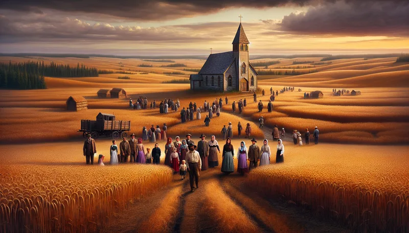
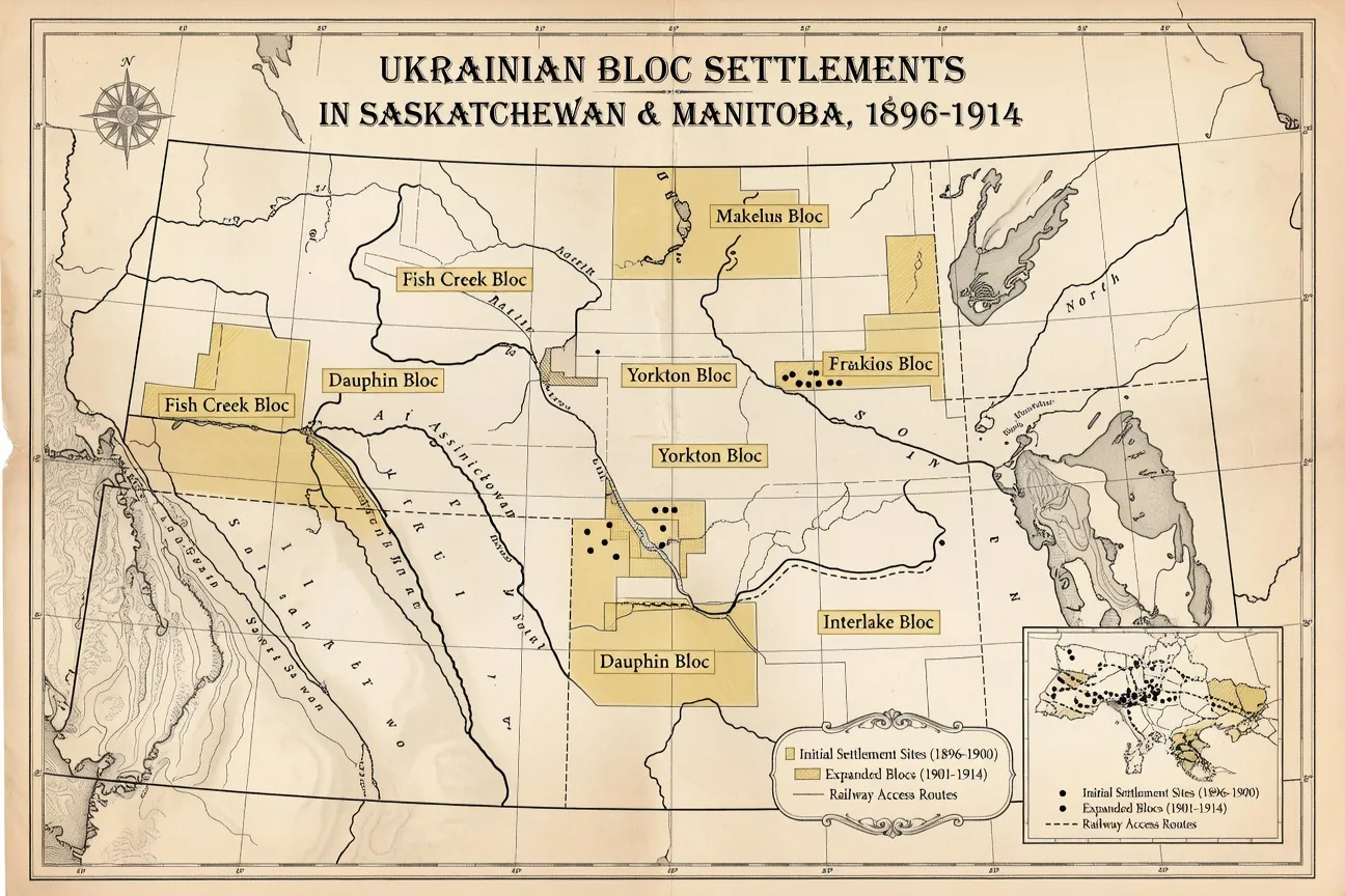
Ukrainian settlement under this system began in earnest in 1891 and accelerated dramatically after Clifford Sifton became Minister of the Interior in 1896. Sifton’s aggressive recruitment of central and eastern European agricultural settlers — famously described in terms later criticized for their ethnic characterizations — brought over 170,000 Ukrainians to Canada before World War I. The vast majority settled in a band of parkland territory across southern Manitoba, Saskatchewan, and Alberta, in bloc settlements that preserved language, religion, and community cohesion while fulfilling the homestead requirements.
For genealogists, this settlement pattern has an important practical consequence: Ukrainian homestead records are geographically clustered. If your ancestor settled in the Canadian west between 1891 and 1914, their homestead is statistically likely to fall within a handful of well-documented Ukrainian bloc settlements: the Stuartburn and Dauphin areas of Manitoba, the Vegreville and Smoky Lake areas of Alberta, or the Yorkton, Canora, and Prince Albert areas of Saskatchewan. Knowing these settlement zones can help narrow a search when a settler’s name is uncertain.
What a Homestead File Contains
The homestead file is a paper dossier assembled over the years it took a settler to prove up their claim — typically three to five years from initial application to final patent. Not every file is complete, and many have gaps due to the destruction of records at various points in the 20th century. But a well-preserved file is one of the most information-rich documents in Canadian genealogical research.
Application form: The initial application names the applicant, gives their nationality, age, and marital status, records the legal land description of the quarter section claimed, and notes any prior claim. Many applications were completed through immigration agents who spoke Ukrainian, and some include the settler’s name in a transliterated form that can reveal the original Ukrainian spelling.
Annual declaration forms: Each year, the homesteader had to declare to a Dominion Lands agent that they were resident on the land and had made improvements. These declarations routinely list the names and ages of all family members living on the homestead. For researchers seeking children’s birth years or a spouse’s maiden name (if she signed the declaration herself), these forms can be invaluable.
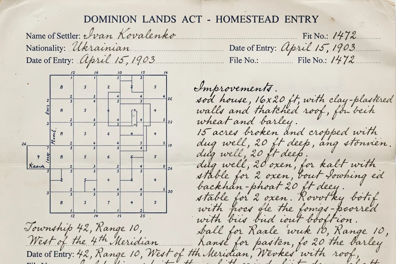
Inspector’s reports: Dominion Lands inspectors visited homesteads to verify that settlers were meeting the requirements for cultivation and residence. Their handwritten reports describe the improvements on the property — the house, barn, fencing, acreage under cultivation — and sometimes comment on the settler’s circumstances or character. These documents bring a human element to the administrative record.
Final entry proof: When a settler completed the homestead requirements, they appeared before a commissioner and swore an affidavit detailing their residence and improvements. This document is typically the most complete autobiographical statement in the file. It names the settler, their spouse, the length of their residence, and the improvements made. Some final entry proofs ask for the place of birth, which can provide the Ukrainian region or even the village of origin.
The land patent: Once the final entry was approved, the government issued a patent — a formal land title document — signed by the Governor General. The patent itself contains relatively little genealogical information beyond the settler’s name and legal land description, but its presence confirms that the homestead was successfully completed.
| Document | What It Reveals |
|---|---|
| Application form | Name, nationality, age, marital status, quarter section claimed; sometimes original Ukrainian spelling via transliteration |
| Annual declaration forms | Names and ages of all family members living on the homestead each year |
| Inspector's reports | Improvements on the property (house, barn, fencing, acreage), sometimes notes on the settler's character |
| Final entry proof | Sworn affidavit with spouse's name, length of residence, improvements, and sometimes place of birth/village |
| Land patent | Formal title document confirming the homestead was successfully completed |
Key takeaway: The final entry proof is usually the single most valuable document in a homestead file — it is the settler's own sworn autobiographical statement, and it sometimes names the specific Ukrainian region or village of birth.
Searching Library and Archives Canada
The primary repository for western Canada homestead records is Library and Archives Canada (LAC) in Ottawa. LAC holds the original files for all Dominion Lands homestead grants, organized by province and legal land description. A substantial portion of these records has been digitized and is searchable through the LAC online database.
The Western Land Grants Database
The Western Land Grants database at bac-lac.gc.ca is the starting point for all homestead research. It is free to access and can be searched by:
- Name: Enter the surname and given name as they appear in Canadian records. Ukrainian names were frequently anglicized on immigration documents — Ivan became John, Mykhailo became Michael, Vasyl became William or Basil. Search the anglicized form first, then try phonetic variants.
- Legal land description: If you know the province, township, range, and section, you can search directly for the occupant. This approach works well when other family members have already been located and the settlement area is known.
The search results include a reference number (MIKAN number), the settler’s name as recorded, the legal land description, the date of the patent, and a note on whether the original file has been digitized. For digitized records, page images of the original documents are available directly from the search result.
For records not yet digitized, LAC accepts requests for scanned copies. The process involves submitting an online request through the LAC website, citing the MIKAN number from the database. Processing times vary but are typically a few weeks for straightforward requests.
Provincial Archives as Complement to LAC
The LAC database is comprehensive for patents but less complete for the supporting file documents (annual declarations, inspector’s reports) that are most genealogically useful. For these supporting records, provincial archives can fill the gap.
Saskatchewan Archives holds the Homestead Records of Saskatchewan, which complement the federal LAC holdings with additional file documents and the Saskatchewan Homestead Index, a searchable database of settlers and their quarter sections. The Saskatchewan Archives’ online search tool is one of the most researcher-friendly in Canada.
Alberta Provincial Archives holds homestead correspondence and related documents for the Territory of Alberta period (pre-1905) and the early provincial period. The Glenbow Museum in Calgary, while not an archives in the formal sense, holds extensive photographic and documentary collections relating to Ukrainian prairie settlement that can provide context for homestead research.
Manitoba Provincial Archives holds territorial records for the earliest Ukrainian settlers, many of whom arrived in Manitoba before Saskatchewan and Alberta were established as provinces in 1905. The Mennonite Heritage Archives in Winnipeg, despite its name, also holds some eastern European immigrant records from the early settlement period.
The Dominion Land Survey System
Understanding the Dominion Land Survey (DLS) system is essential for interpreting homestead records, plotting a farm’s location, and connecting a homestead to a community or parish.
How the Grid Works
The DLS divided the western prairies into a uniform grid of townships running east to west and north to south. Townships are numbered from south to north beginning at the US border. Each township consists of 36 sections of one square mile (640 acres) each, numbered in a specific pattern beginning in the southeast corner. Each section is divided into four quarter sections of 160 acres, designated as NE (northeast), NW (northwest), SE (southeast), and SW (southwest).
A complete legal land description identifies a quarter section uniquely across all three prairie provinces:
SW-14-42-18-W3M means:
| Element | Value | Meaning |
|---|---|---|
| SW | Southwest | Quarter section within the section |
| 14 | Section 14 | One of 36 one-square-mile sections in the township |
| 42 | Township 42 | Numbered north from the US border |
| 18 | Range 18 | Numbered from the applicable meridian |
| W3M | West of the Third Meridian | Baseline running through central Alberta |
- SW: southwest quarter
- 14: section 14
- 42: township 42
- 18: range 18
- W3M: west of the third meridian
The meridians are north-south baselines used to organize the range numbering system. The First Meridian runs through Winnipeg; the Second through approximately Lloydminster; the Third through the centre of Alberta.
Using the Survey to Locate an Ancestral Farm
Once you have a legal land description, you can locate your ancestor’s homestead precisely using several tools:
- GeoGratis Canada (Natural Resources Canada) provides historical and current township maps that can be downloaded for free.
- Historical county maps at the University of Alberta Libraries show early 20th-century settlements with settler names on the quarter sections.
- Google Maps can be used to approximate a homestead location by working from the township and range coordinates — a useful way to identify the nearest modern town and community.
- Church parish boundaries in the Ukrainian bloc settlements often correspond to the township grid, allowing researchers to move from a homestead location to the specific Greek Catholic or Orthodox parish where vital records were kept.
This connection between land survey location and church parish is particularly valuable for genealogy. Once you know which quarter section your ancestor farmed, you can identify the Ukrainian Greek Catholic or Orthodox parish that would have served that settlement, and from there access the Canadian church records that link back to the Ukrainian village of origin. For the full journey from Canadian homestead to Ukrainian archive, see our guide to Canadian immigration records for Ukrainian ancestors.
Scrip Records: A Specialized Category
Scrip was a government-issued certificate representing a right to land or cash, issued primarily to Métis people recognizing their Indigenous heritage rights under the Manitoba Act of 1870 and subsequent legislation. Scrip records are distinct from homestead records but appear in the same archival collections and are occasionally relevant to Ukrainian genealogy research in specific circumstances.
Ukrainian settlers rarely received scrip directly — it was a mechanism for recognizing pre-existing land rights, not for awarding land to new immigrants. However, there are several ways scrip records can appear in the genealogical path of Ukrainian families:
Land purchase chains: Some Ukrainian settlers purchased or inherited land that had previously been acquired through scrip. Land title records, which trace the chain of ownership for a specific quarter section, may include a scrip grant early in the chain before the land was transferred to a Ukrainian family through purchase.
Mixed-heritage families: In rare cases, families with mixed Métis and Ukrainian ancestry may appear in both scrip and homestead records across generations. The Métis National Council’s genealogical resources can assist researchers working across this documentary boundary.
Scrip as context for settlement patterns: Understanding that the Métis had already occupied and farmed much of the land before Ukrainian arrival helps interpret the settlement patterns and community tensions recorded in some homestead files.
The LAC scrip database is searchable online and separate from the Western Land Grants database. If your research involves families from the earliest settlement period (1870s–1890s) in Manitoba, consulting scrip records in parallel with homestead records can provide a fuller picture of the land tenure history in a specific area.
When Records Are Missing or Damaged
Not every homestead claim resulted in a complete file, and not every file survived intact. Researchers should be prepared for several common gaps:
Cancelled entries: A settler who failed to complete the homestead requirements — who abandoned the land, died before proving up, or lost their claim through administrative cancellation — left only the initial application and perhaps one or two annual declarations. These partial files can still be genealogically useful (the application names and describes the settler) but will not include the autobiographical final entry proof.
Record loss: A fire at a federal land office in Regina in 1926 destroyed some original files. LAC has reconstructed partial records from duplicate copies held at provincial level, but some files remain incomplete or missing. If a search in the LAC database returns no result for a known settler, checking provincial archives for duplicates is the recommended next step.
Name variations and transliteration problems: Ukrainian names were recorded by anglophone agents who heard them phonetically and recorded what they thought they heard. Kovalenko became Kowalenko, Kovalchuk became Kowalchuk or Coultchook, Shevchenko might appear as Shefchenko or Chevchenko. The LAC database supports partial-name searches and some phonetic matching, but a comprehensive search should also try name variants systematically.
Common pitfall: Searching the LAC database only under the Ukrainian spelling of a surname. Anglicized transliterations (Kovalenko/Kowalenko, Shevchenko/Shefchenko) were recorded phonetically by agents who did not speak Ukrainian — always search multiple spelling variants.
Common pitfall: Searching the LAC database with only the "correct" Ukrainian spelling of a surname. Homestead clerks recorded names phonetically, so a single ancestor may appear under three or four different anglicized spellings across different documents — always search systematically through the likely variants before concluding a record does not exist.
Multiple claimants: In some bloc settlements, more than one Ukrainian settler with the same common surname and similar given name appears in the records for the same township. Without supporting documents — the ship manifest, a church record with children’s names, a naturalization paper with a village of origin — distinguishing between two Vasyl Kovalenkos in adjacent quarter sections requires careful cross-referencing.
Connecting Homestead Records to Ukrainian Archives
The homestead record is rarely the endpoint of Ukrainian genealogical research — it is the link between the Canadian documentary record and the archives in Ukraine. The connection works in both directions.
From Canada to Ukraine: The final entry proof or the initial application may state the settler’s place of birth. This might read “Galicia, Austria,” or more specifically “Borshchiv, Galicia” or “near Lviv.” Any place name, however vague, can be used as a starting point for Ukrainian archive research. A village name identified in a homestead record can be checked against the Greek Catholic metrical books at TsDIAL in Lviv — many of which are now freely viewable online through FamilySearch — potentially extending the family tree by several generations.
From Ukraine to Canada: If archive research in Ukraine establishes the full names and birth dates of a settler and their family members, those details can be used to search the LAC database more precisely — particularly when an anglicized name in Canadian records has proven difficult to connect to the Ukrainian family.
The complete research chain — Lviv archive → ship manifest → homestead record → naturalization papers → Canadian church record — is the gold standard for Ukrainian-Canadian genealogy. Each document type complements the others, and a gap in one is often bridgeable through another. For the Galician migration context that placed most Ukrainian homesteaders on the prairies, see our detailed overview of Galicia to Canada Ukrainian migration between 1891 and 1914.
Practical Steps for Beginning a Homestead Search
If you are beginning a search for a Ukrainian ancestor’s homestead record, the following sequence is the most efficient approach:
Homestead records were not limited to men -- widows could and did hold entries in their own right. See our guide to tracing Ukrainian-Canadian women through marriage and maiden-name records.
1. Establish the settler’s name in its Canadian form. Canadian homestead records use the settler’s name as it appeared in Canadian administrative documents, not necessarily as it was spelled in Ukrainian. Check immigration records, naturalization papers, or census records for the anglicized spelling before searching LAC.
2. Search the LAC Western Land Grants database by name. Enter each name variant you have identified. Record all results, noting the province, legal land description, and patent date. If more than one result appears for the same name, use the date and province to narrow candidates.
3. Note the MIKAN number and request the full file. The database entry gives you the reference number for the original file. If the file has been digitized, access it directly. If not, submit a copy request to LAC.
4. Decode the legal land description. Use the township-range-section formula to locate the homestead on a historical map. Identify the nearest Ukrainian community, church, and school district.
5. Identify the church parish for that location. The Greek Catholic and Orthodox eparchies of the prairie provinces maintained their own directories of parishes and mission stations. Once you know the township, you can identify which parish held vital records for families farming that land.
6. Cross-reference with provincial archives. If the LAC file is incomplete, contact the provincial archives for the relevant province (Saskatchewan, Manitoba, or Alberta) for supplementary records.
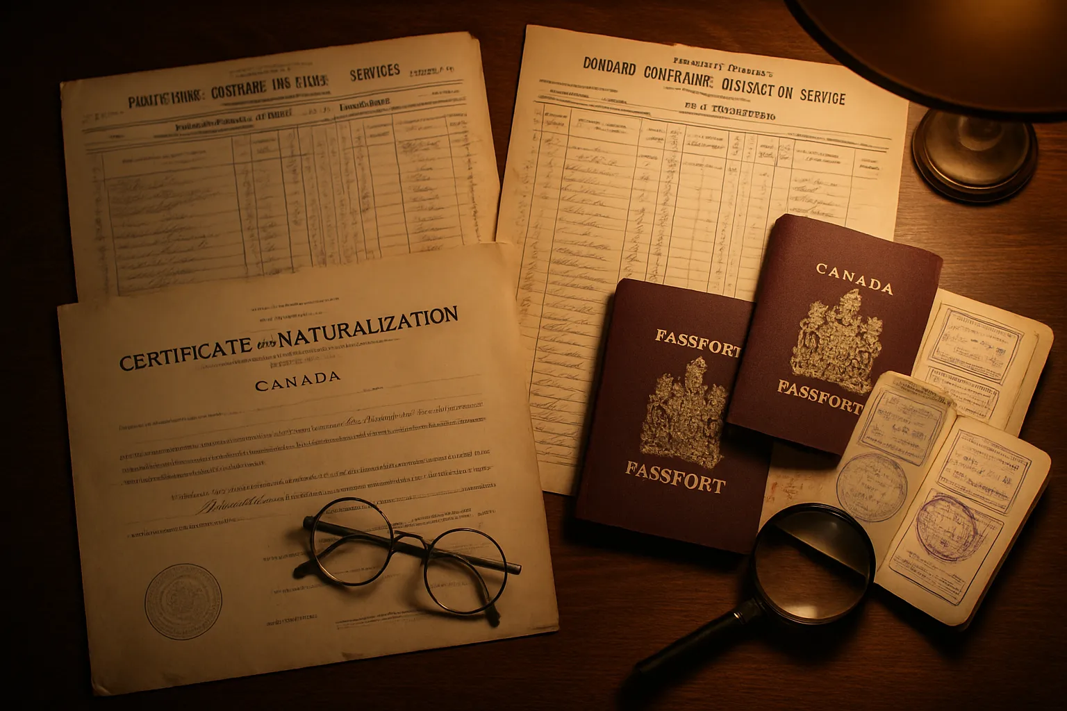
7. Extend to naturalization and census records. The 1906, 1911, and 1916 prairie censuses and the Dominion naturalization records at LAC frequently list homestead residents with additional biographical details, including the country and region of origin. These records can close the gap between “Galicia” and a specific village name. For a complete overview of how these Canadian records fit into the larger research chain, see our guide on how to start Ukrainian genealogy research.
8. Use historical maps to visualize the settlement area. Once you have a legal land description, historical map resources for Ukrainian genealogy can help you plot the exact location of your ancestor’s quarter section and identify the surrounding Ukrainian community, church, and school district.
The Homestead Record as a Family Document
Beyond its genealogical utility, the homestead record is a historical document of remarkable intimacy. A final entry proof, sworn before a commissioner in a frontier land office, captures a moment in a settler’s life that few other documents reach. An ancestor who signed their mark (an X, because they could not write their name) on a homestead application in 1899 left a physical trace of who they were and what they were attempting to build in a country they had arrived in only a few years before.
The inspector’s notes describing a two-room log house with a stable attached, the cultivation of 15 acres, and a family of four living on the claim represent something a ship manifest or census record cannot: evidence of the life that was being built, year by year, on the specific piece of ground where your ancestor made their bet on Canada. For many Ukrainian-Canadian families, these records are the closest surviving documentation of the generation that made the founding journey — the ones who came with almost nothing and broke the prairie for those who followed.
Frequently Asked Questions
The primary source is Library and Archives Canada (LAC), which holds the Western Land Grants database. You can search it for free online at bac-lac.gc.ca by name or by legal land description. For records not yet digitized, LAC accepts written requests. Some provincial archives (Manitoba, Saskatchewan, Alberta) hold complementary local records. The LAC Western Land Grants database covers patents issued from the 1870s to roughly 1930.
A complete homestead file typically includes the original application (with the settler's name, birthplace, and intended quarter section), annual declaration forms (listing family members, cultivation progress, and livestock), inspector's reports (describing the homestead's improvements and the settler's character), the final entry proof (sworn testimony before a commissioner), and the land patent itself (the official title document). Together these records can establish the settler's origins, spouse's name, children's names and ages, and date of arrival in Canada.
The Dominion Land Survey divided the western prairies into townships (36 square miles), each subdivided into 36 sections of one square mile (640 acres). Each section was further divided into quarter sections (northeast, northwest, southeast, southwest) of 160 acres — the standard homestead unit. A legal land description reads like NE-15-47-20-W3, meaning the northeast quarter of section 15, township 47, range 20, west of the third meridian. To use this in genealogy: find the land description in an immigrant's naturalization papers or from the LAC database, then plot it on a historical township map to identify the exact location of your ancestor's farm.
Scrip was a certificate issued by the Canadian government allowing the holder to acquire land or cash in lieu of land. Scrip was primarily issued to Métis people recognizing their Indigenous heritage rights under the Manitoba Act (1870) and the Dominion Lands Act. Some early Ukrainian settlers, particularly those who arrived in the 1890s as part of organized Galician blocks, occasionally appear in scrip-adjacent records due to land transfer chains — when a settler purchased or occupied land that had originally been granted via Métis scrip. Scrip records themselves are held at LAC and are searchable through the virtual archives.
Once you have the legal land description from a homestead record (e.g., NW-22-50-14-W2), you can locate it precisely using several free tools. The Saskatchewan Homestead Index (available via Saskatchewan Archives) and the Alberta Homestead Records database both map locations. For all three prairie provinces, Glenbow Museum's historical township maps and the LAC Online MIKAN collection include township plans showing original settler names. The University of Manitoba Archives and the provincial land title offices also hold survey maps that identify quarter-section occupants by name.